New Mexico Here We Come? 6/15/2008 (Page One)
Carri Fox has been a friend and dance teacher for twenty+ years and she decided to move to New Mexico. We volunteered to drive along with her and move her belongings since we have " big truck ". The truck is 10 years old and has about 40,000 miles on it so it the truck's first big adventure also!
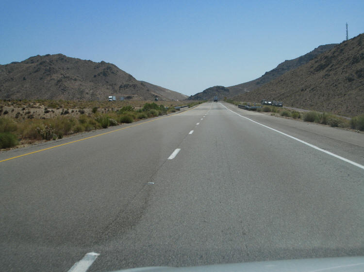
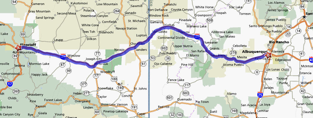
The trip is about 795 miles which should take about eleven and a half hours (according to Mapquest ). We will spend 671 miles on good old Interstate 40. Pulling a trailer will slow it up a bit so we expect it will be more like fifteen hours.
The Route Took Us On Interstate 40

Barstow, California

Barstow is a city in San Bernardino County, California, United States. The population was 21,119 at the 2000 census.
Needles, California

Needles (Mojave 'Aha Kuloh) is a city located on the western banks of the Colorado River in San Bernardino County, California.
There Was Miles And Miles Of Miles And Miles On I-40
Kingman, Arizona
 Kingman Arizona was founded in 1882. Situated in the scenic Hualapai Valley between the Cerbat and Hualapai mountain ranges. It is known for its very modest beginnings as a simple railroad siding near Beale’s Springs in the Middleton Section along the newly constructed route of the Atlantic and Pacific Railroad.
Williams, Arizona
 Williams is in Northern Arizona, 60 miles south of the Grand Canyon. The southern point of the Grand Canyon Railway is here in Williams along with several alternatives to lodging at the Grand Canyon.
Seligman, Arizona
 Seligman, Arizona is a Route 66 town all the way. Seligman is located at [show location on an interactive map] 35°19′42″N, 112°52′27″W (35.328199, -112.874303), at 5,240 feet in elevation. It lies on the route of Historic Route 66, and its predecessor, the Mojave Road. It's population is about 500.
Flagstaff, Arizona... Our Turning Point
 We "bypass" downtown Flagstaff as we leave I40 for S89 and then S89A. Flagstaff (Navajo: Kinłání) is a city located in northern Arizona, in the southwestern United States. As of July 2006, the city's estimated population was 58,213. The population of the Metropolitan Statistical Area was estimated at 127,450 in 2007.
New Territory
On our Phoenix/Sedona trip in late May 2008 we posted information on the towns we went through . Now we are in new territory so please read on.
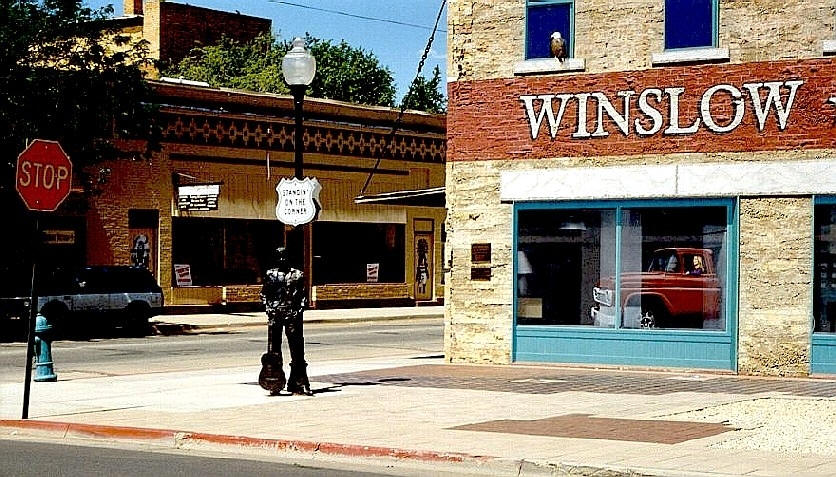
Winslow Arizona
The nearby Meteor Crater, sometimes known as the Barringer Crater and formerly as the Canyon Diablo crater, is a famous impact crater.
Winslow is also home to the 9-11 Remembrance Gardens, a memorial honoring those who lost their lives during the September 11th terrorist attacks. The memorial was constructed using two beams recovered from the wreckage of the World Trade Center towers in New York City.
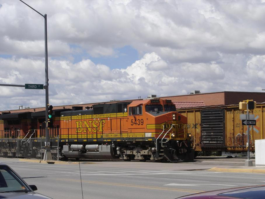
Winslow is situated on one of the busiest railroad lines in the U.S with more than 100 freight trains passing through Winslow daily. The town is on the Burlington Northern Railroad's Santa Fe Transcon route which runs between Los Angeles, California and Chicago, Illinois. It is a crew change point for the BNSF Railway. The town also has twice-daily Amtrak service at Winslow (Amtrak station) (one train each eastbound and westbound).
Gallup
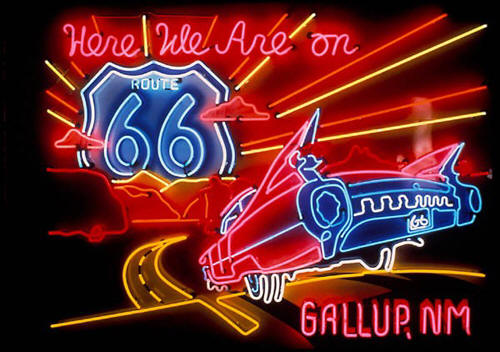
Gallup was founded in 1891 as a railhead for the Atlantic and Pacific Railroad. The City was named after David Gallup, a paymaster for the Atlantic and Pacific Railroad. It is the most populous city between Albuquerque, New Mexico and Flagstaff, Arizona.
Gallup is sometimes called the "Indian Capital of the World", for its location in the heart of Native American lands, and the presence of Navajo, Zuni, Hopi and other tribes. One-third of the city's population have Native American roots. Gallup has references the huge impact of the Native American Cultures found in and around Gallup.
Route 66 runs through Gallup, and the town's name is mentioned in the lyrics to the song, Route 66. In 2003, the U.S. and New Mexico Departments of Transportation renamed US Highway 666, the city's other major highway to Route 491 since the number "666" is associated with Satan and devil worship, thus it was offensive to some people and local Navajos some who are superstitious felt it will lift the route from being "cursed"
Gallup experiences four seasons with large daily temperature ranges. Winter mornings can be very cold, with temperatures in the 0s to low 10s F. However, by mid-afternoon, it is not uncommon for the temperature to be close to 50 F. Summer afternoons have temperatures near 90 F, and can fall into the 40s and 50s by dawn.

We Crossed The The Continental Divide
A continental divide is a line of elevated terrain which forms a border between two watersheds such that water falling on one side of the line eventually travels to one ocean or body of water, and water on the other side travels to another, generally on the opposite side of the continent. Because the exact border between bodies of water is usually not clearly defined, the continental divide is not always definite for any continent (The International Hydrographic Organization's publication Limits of Oceans and Seas defines exact boundaries of oceans.
Kirkland Air Force Base
Kirtland Air Force Base (IATA: ABQ, ICAO: KABQ) is a major United States Air Force base located in the southeast quadrant of Albuquerque, New Mexico, USA, adjacent to the Albuquerque International Sunport. The military and the international airport share the same runways, making ABQ a joint civil-military airport.

The base is the third largest installation in Air Force Materiel Command, covering 51,558 acres (209 km²) and employing over 23,000 people, including more than 4,200 active duty, 3,200 part-time Air Force Reserve and 1,000 Air National Guard personnel.
Kirtland is the home of the Air Force Materiel Command's Nuclear Weapons Center (NWC). The NWC is the center of expertise for nuclear weapon systems, ensuring safe, secure and reliable nuclear weapons are available to support the National Command Structure and Air Force. The NWC's responsibilities include acquisition, modernization and sustainment of nuclear system programs for both the Department of Defense and Department of Energy.
