Farmington New Mexico To Laughlin Nevada
We were going to go to Las Vegas but decided to get a little closer to home since we had Zachary's graduation to go to. We decided that Laughlin would be our target today!
Farmington To St George On Highways 64/160/98/89/9 Was A Pretty As It Gets!
64 - From Farmington to Teec Nos Pas which is the western end of the highway. Interestingly enough Highway 64 goes through Paul's father's hometown of McRae Arkansas on its was to the east coast!
160 - To junction 191
191 - North into Utah until we get to 163 where we turn west
163 - Through Mexican Hat and into the Navajo Indian Reservation and through Kayenta where we reconnect with 160. We leave Utah and pass into Arizona.
160 - Continued west to Junction 98.
98 - We pass through more Navajo Indian land and end up in Page Arizona where we visit the dam holding back lake Powell!
89 - We go south from Page on 89 to 89 Alternate and head north toward Fredonia. At fredonia we catch a very small highway 389. The entire Highway 89-A/Highway 89 loop circles the massive Paria Plateau and northern Kaibab Plateau Uplift. Again, these routes show the desire for mobility and transportation of people and goods, as they penetrate what were thought to be impenetrable physical barriers such as the Kaibab Plateau, Marble Canyon, Glen Canyon, and the Cockscomb. 89A urns into 59 at the Arizona/Utah border.
9 - A short jump from Hurricane to St. George where we caught the I-15 for a run to Laughlin.

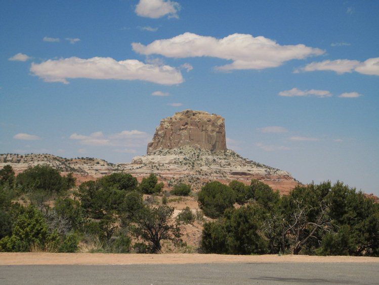
Shiprock is named after the nearby Shiprock rock formation. It is home to the annual Northern Navajo Fair, held every October. It is also home to a campus of Diné College (formerly Navajo Community College), a tribally controlled community college with 7 other campuses across the Navajo Nation. It is the site of a Chapter House for the Navajo and a BIA Agency. It is the site of a branch of Farmington Public Library. Shiprock is a key road junction for truck traffic and tourists visiting the Four Corners, Mesa Verde, and the Grand Canyon. The town lies at the intersection of U.S. Highways 64 and 491 (formerly U.S. Highway 666.) Despite its location at the confluence of two substantial roads and close to many tourist locations the town is notable for having no hotels or motels, the nearest options being in Farmington, New Mexico to the East and Cortez, Colorado to the North.

From A distance it looks like a ship!
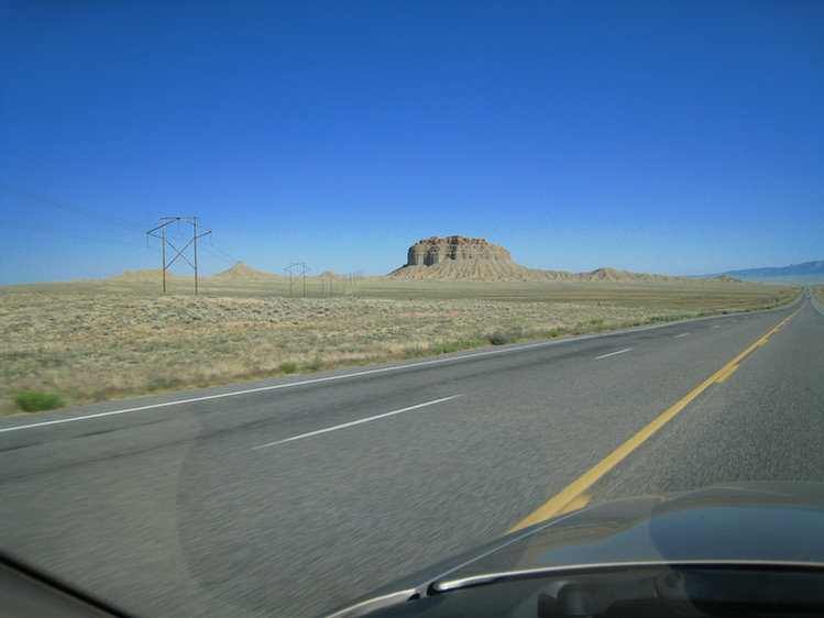
On our way to four corners
Four Corners
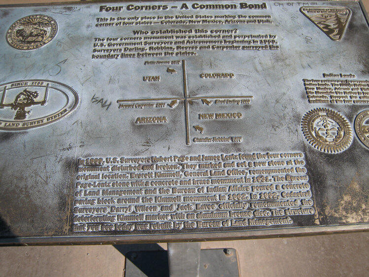
The Four Corners is a region of the United States consisting of southwest Colorado, northwest New Mexico, northeast Arizona and southeast Utah. The name comes from the Four Corners Monument, located where the four states touch — the only location in the United States that is on the boundaries of as many as four states. The majority of the Four Corners region is part of sovereign indigenous nations. Two of these are the Navajo Nation and the Ute Mountain Ute Indian Reservation which have a boundary at the Four Corners Monument in addition to the four states. The economic capital and largest city in the region is Farmington, New Mexico.
The United States first acquired the area now called Four Corners from Mexico after the Mexican American War in 1848. The area was first surveyed by the U.S. Government in 1868 as part of an effort to form the state of Colorado, the first of the Four Corners states formed. The Four Corners was established as the jurisdictional boundary in 1901 when the boundaries of the state of Arizona were established. The first marker was placed at the spot in 1912. The first Navajo tribal government was established in 1923 to regulate an increasing number of oil exploration activities on Navajo tribal lands.


Costs $3.00/person so see the site

The monument is surrounded by the flags of the various states

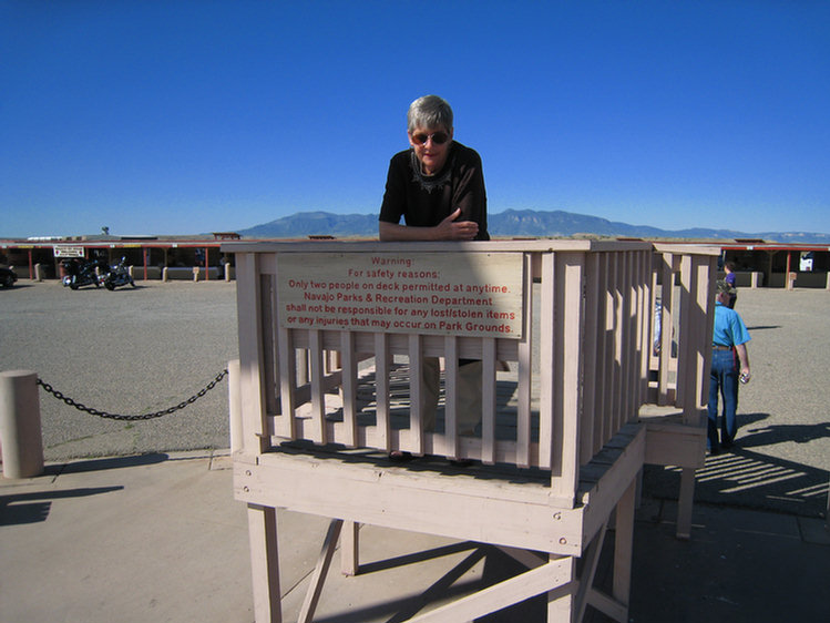
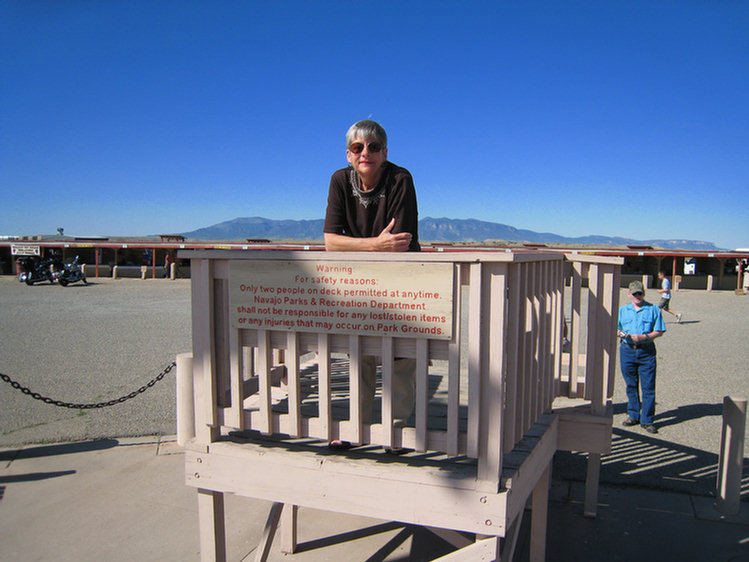
From here you can see 100 miles into each state!


Put your foot on the spot and you are in four states at one time!
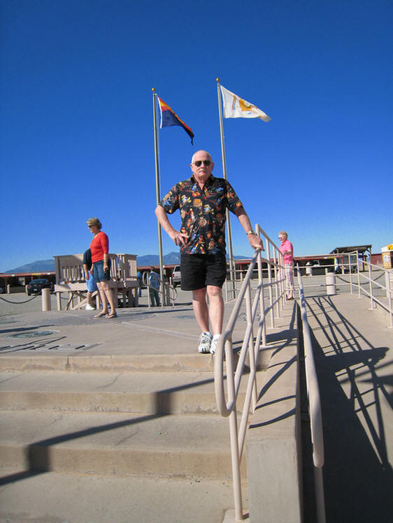

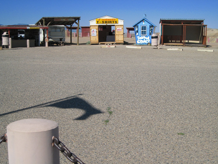
The Indians are always selling jewelry and T-Shirts wherever one stops!

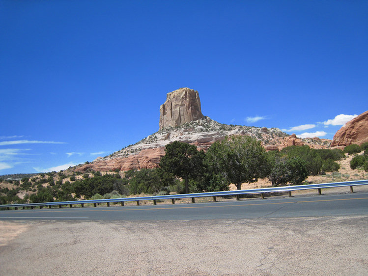
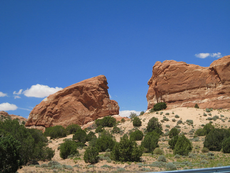
From Four Corners We Headed North West To Colorado Through Teec Nos Pos, Red Mesa, Mexcan Water, and Dennehotso On Highway 64
Red Mesa is a census-designated place (CDP) in Apache County, Arizona, United States. The population was 237 at the 2000 census.

Definitely a mesa and definitely red!

Kayenta Arizona
Kayenta is a census-designated place which is part of the Navajo Nation and is in Navajo County, Arizona, USA. The population was 4,922 at the 2000 census. Kayenta is located immediately south of Monument Valley (some of the buttes of which are visible from Kayenta's streets) and contains a number of hotels and motels which service visitors to the valley. Like other places in the Navajo Nation, it is illegal to serve alcohol in Kayenta. Arizona does not observe Daylight Time, however the Navajo reservation does.
Kayenta Township is the only municipal-style government within the Navajo Nation. It is regarded as a political sub-division of the Navajo Nation. It is managed by a five-member elected town board, which hires the township manager.
Kayenta is the name for the Chapter, as well as the township. Kayenta Chapter (a political division within the Navajo Nation that is analogous to a county within a state) encompasses land in both Utah and Arizona.

Po Box 652 - Kayenta, AZ 86033 - Great place to grab a bite to eat!!


Kaibito Arizona On State Hwy 98
The town was only 1,600 people and seemed to be closed for the day.

We Visited The Glen Canyon Dam
Glen Canyon Dam is a dam on the Colorado River at Page, Arizona, USA, operated by the United States Bureau of Reclamation. The purpose of the dam is to provide water storage for the arid southwestern United States, and to generate electricity for the region's growing population. Damming the river flooded Glen Canyon and created a large reservoir called Lake Powell. Just downstream from the dam is an arch bridge that carries U.S. Route 89. See more about the Glen Canyon Dam.

A magnificent feat of human engunity
Lake Powell is named for John Wesley Powell, a colorful, one-armed explorer and Civil War veteran who led nine companions on the first scientific expedition of the Colorado River in 1869. Powell and his men embarked on a remarkable journey that covered almost 1,000 miles through the uncharted canyons and wild rapids of the Colorado River. This expedition, followed by a second one in 1871 which produced the first maps of the region, changed the future of the American West forever.
Page Arizona (Left Turn From 98 to 89)
Page is a town in Coconino County, Arizona, United States, near the Glen Canyon Dam and Lake Powell. According to 2005 Census Bureau estimates, the population of the town is 6,794. The City of Page is one of the youngest communities in the United States. It is located in northeastern Arizona, approximately five hours north of Phoenix and five hours east of Las Vegas.The town began in 1957 as a housing camp for workers building the Glen Canyon Dam. In 1958, some 24 square miles of Navajo land were exchanged for a larger tract in Utah, and "Government Camp" (later called Page in honor of Bureau of Reclamation Commissioner John C. Page) was born. At first, the frontier community consisted of temporary homes and house trailers, with a few streets carved out of the sandy, rocky slopes. Gradually, permanent homes were constructed and churches sprang up along Lake Powell Boulevard. Twelve religious denominations were granted building sites; today, that portion of Lake Powell Boulevard is affectionately called "Church Row" by local residents. During the seven years required to construct the dam, Page was a federal municipality. It became an incorporated town on March 1, 1975 and is now home to more than 9,000 people.

An oasis in the middle of the desert!
Their reservation adjacent to Page contains more than 16 million acres (27,000 square miles) and extends into both Utah and New Mexico. Today the Navajo Nation is home to about 200,000 tribal members. While incorporating many aspects of modern technology, some Navajos retain their traditional lifestyles as farmers and sheep herders.
Page Arizona To St George Utah

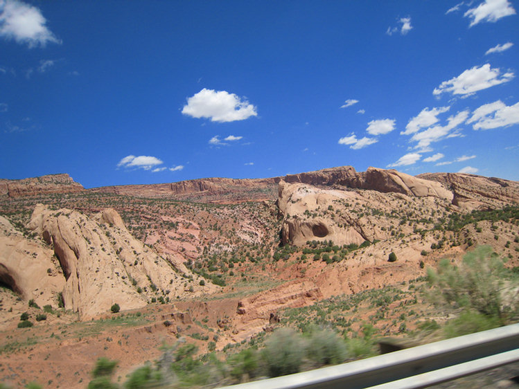
Page to St George Had Magnificent Views
Kanab is a city in Kane County, Utah, United States. The population was 3,564 at the 2000 census. It is the county seat of Kane County[3]. Locals refer to Kanab as "Little Hollywood" due to its history as a filming location for western movies. Kanab is situated in the "Golden Circle," centrally located among Bryce Canyon National Park, the Grand Canyon (North Rim), and Zion National Park.
Named for a Paiute word meaning "place of the willows," Kanab was settled in 1864 when Fort Kanab was built on the east bank of Kanab Creek for defense against the Indians and as a base for the exploration of the area. Indian attacks forced the abadonment of the fort in 1866. In 1870, ten Mormon families moved into the fort and began to establish the present town. That same year Brigham Young, Prophet and President of the mormon church, visited the area twice, making suggestions and supervising the town planning.
For many years Kanab was one of the most isolated cities in the nation. It was cut off from the east by the Colorado River and could only be reached with difficulty by rough dirt roads stretching over the rough terrain of the Arizona Strip west toward Las Vegas, NV. A twenty three mile journey north to Orderville, UT took nearly four days. Perhaps this isolation is why Zane Gray lived in the town while writing his Riders of the Purple Sage in 1912.

Views from Kanab Utah
Fredonia is a town in Coconino County, Arizona, United States. According to 2006 Census Bureau estimates, the population of the town is 1,051. It was settled in 1885 by Mormon pioneers from Kanab, Utah. The word "Fredonia" was coined by Samuel Latham Mitchill, combining "freedom" with a Latin ending. Mitchill proposed the name as a replacement for the United States. It failed in that regard but was adopted as the name of many towns and cities. According to George R. Stewart, the meaning of the Arizona town of Fredonia is sometimes said, falsely, to be the joining of English "free" and Spanish "doña", thus meaning "free woman", supposedly referring to polygamous Mormons.

Fredonia us in the wide open spaces
The Vermilion Cliffs Highways encompass parts of Interstate 15, and State Highways 9, 59, 389, 89 and 89-A. See the pictures to understand why it was named so!


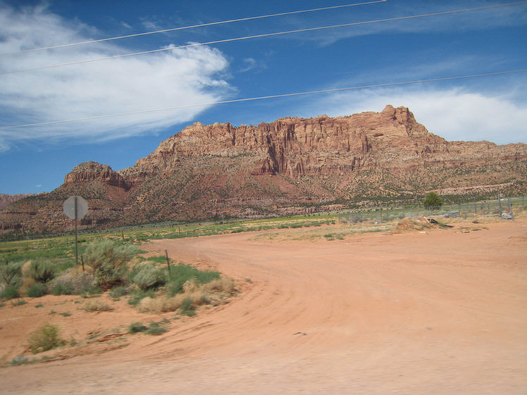

Highways 59 and 389 go across the rolling slopes of sand-covered Chinle and Moenkopi geologic formations. The imposing ramparts of Canaan Mountain rise above Colorado City, Arizona bringing the Vermilion Cliffs close to the highway where the intricate colors and textures of the various rock formations may be seen more readily.
The cottonwood-lined banks of Short Creek, emerging from the Vermilion Cliffs at Colorado City show that good townsites require water; whether bustling, growing towns of today or Virgin Anasazi villages of the far past--both are present here.
Highways 59 and 389 parallel the slow curve of the Vermilion Cliffs until reaching the town of Fredonia, Arizona. A small town of less than one thousand residents, Fredonia possesses a rich history of "exploration and survival", from early explorations and accounts by Sharlot Hall, John Wesley Powell, and Clarence Dutton to a more modern day "survival" based on the use of timber, mineral, grazing, and tourist resources.
Highway 89-A and Highway 89 - Fredonia is a western point of departure for the Highway 89-A and Highway 89 loop. This loop proceeds east on Highway 89-A from Fredonia through wide open landscapes of rolling sage plains that slowly rise to the approach of the Kaibab Plateau, or west Kaibab Monocline.

Colorado City

We could not pass up this picture!
Colorado City is a town in Mohave County, Arizona, United States and is located in a region known as the Arizona Strip. According to 2006 Census Bureau estimates, the population of the town was 4,607. At least three Mormon fundamentalist sects are said to have been based there. Colorado City, formerly known as Short Creek (or the Short Creek Community), was founded in 1913 by members of the Fundamentalist Church of Jesus Christ of Latter Day Saints, a breakaway sect of the Salt Lake City-based The Church of Jesus Christ of Latter-day Saints. The FLDS membership desired a remote location to perpetuate the practice of plural marriage that the mainstream church abandoned by public pronouncement in 1890. On July 26, 1953, Arizona Governor John Howard Pyle sent troops into the settlement to stop polygamy in what became known as the Short Creek raid. The two-year legal battle that followed became a public relations disaster that doomed Pyle's political career and set a hands-off tone toward the town in Arizona for the next fifty years.


The road into Colorado City
Hurricane is a city in Washington County, Utah, United States. The population was 8,250 at the 2000 census and by 2004 had been estimated to increase to 9,748. Hurricane has seen tremendous population growth along with many other areas of southwest Utah since the 1970s and has blended into neighboring St. George. Hurricane received its name after a whirlwind blew the top off a buggy Erastus Snow was riding in. Snow exclaimed, "Well, that was a Hurricane. We'll name this Hurricane Hill.

Hurricane is located in the area surrounding the river
St. George is a city located in the southwestern part of the U.S. state of Utah, and the county seat of Washington County, Utah. It is the principal city of and is included in the St. George, Utah Metropolitan Statistical Area. The city is 119 miles (192 km) northeast of Las Vegas, Nevada, and 303 miles (488 km) south of Salt Lake City on Interstate 15.
St. George is the population and commercial center of Utah's Dixie, a nickname given to the area when Mormon pioneers grew cotton in the warm climate. St. George's trademark is its geology — red bluffs make up the northern part of the city with two peaks covered in lava rock in the city's center. The northeastern edges of the Mojave Desert are visible to the south. Zion National Park can be seen to the east, and the Pine Valley Mountains loom over the city to the north and northwest. The climate has more in common with the Desert Southwest than the rest of the state, with scorching hot summers and mild, mostly snowless winters. The city has recently developed into a major retirement destination.

St George is our end to days of back roads!
St George Utah To Laughlin Nevada Via Interstate 15.... Boring!
We jumped on Interstate 15 for the drive into Laughlin.

No pictures as it ws just plain interstate highway and desert!