Time To Celebrate Lisa's Birthday & Visit Delores And Aunt Kaye
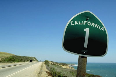
Were off to see Lisa and celebrate here 16th birthday.... We departed home at 9:30am and took the route up PCH through Malibu, Santa Barbara and connected with 101 in Buellton where we had lunch. It was a straight shot into Saratoga arriving at 5:30pm. Eight hours of leisurely travel and a great lunch at Andersen's Split Pea Restaurant.

Time for a ROAD TRIP!!!

Memories of long long ago just a bit north of Santa Monica!
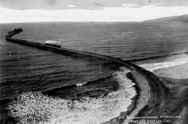
Did You Know? - Long Wharf, the attempt by Santa Monica, California-backers to have the Port of Los Angeles based in Santa Monica, 1893 (they would lose to backers of the San Pedro, California location). Note the train on the pier, it was the longest pier in the world when constructed.

The flowers were magnificent all the way up
Did You Know? - Mustards are several plant species in the genera Brassica and Sinapis whose small mustard seeds are used as a spice and, by grinding and mixing them with water, vinegar or other liquids, are turned into the condiment known as mustard or prepared mustard. The seeds are also pressed to make mustard oil, and the edible leaves can be eaten as mustard greens.
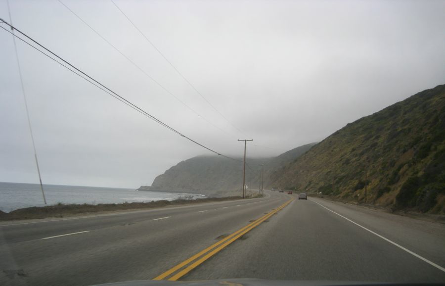
The fog was with us all along the coast
especially around Port Hueneme
Did You Know? - The Port of Hueneme is the only deep water port between the Port of Los Angeles and the Port of San Francisco, and the only Navy controlled harbor between San Diego Bay and Puget Sound.
The harbor is a shipping and receiving point for a wide variety of goods destined for the Los Angeles Basin and beyond, including automobiles, pineapples, and bananas. Agricultural products such as onions, strawberries, and flowers are shipped.
The United States Navy maintains a facility at Port Hueneme, in support of the naval air station at Point Mugu to the south and San Nicolas Island 60 miles (97 km) offshore, with which it comprises Naval Construction Battalion Center Port Hueneme. Port Hueneme is the West Coast home of the Construction Battalion, the famous "Seabees", as well as a link in the coastal radar system. On the base is the U.S. Navy Seabee Museum, one of fifteen official U.S. Navy museums.
It Was Drizzling At The Gaviota Rest Stop...

We stopped at the Rest Area at Gaviota
where the fog hit the mountains and dizzle was the result
Did You Know? - Gaviota is an unincorporated town in Santa Barbara County, California located about 30 miles (48 km) west of Santa Barbara and 15 miles (24 km) south of Buellton. Approximately 35 people live in and near Gaviota. The ZIP Code is 93117, and the community is inside area code 805.

In the sunshine it looks like this
Just a drizzle
today...

Did You Know? - Drizzle is a light rain precipitation consisting of liquid water drops smaller than those of rain, and generally smaller than 0.5 mm (0.02 in.) in diameter. Drizzle is normally produced by low stratiform clouds and stratocumulus clouds. Precipitation rates due to drizzle are on the order of a millimetre per day or less at the ground. Owing to the small size of drizzle drops, under many circumstances drizzle largely evaporates before reaching the surface, and so may be undetected by observers on the ground. The METAR code for drizzle is DZ.
High And Dry At Andersen's Split Pea Soup
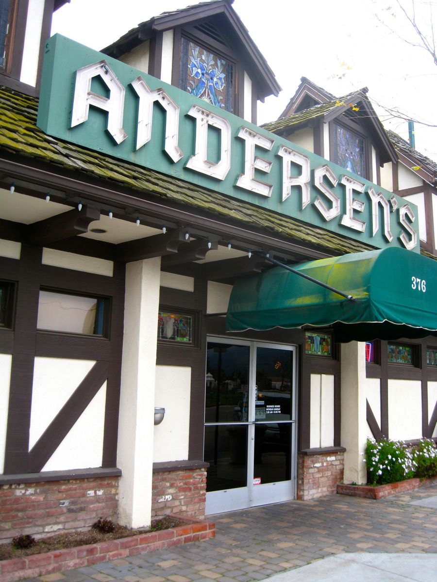
Andersen's History - A super place to eat!!!
Did You Know? - And good for you! They are a great source of protein and are also very lean and healthy, with only 1 gram of fat per 350 calorie serving. Most of the calories come from protein and complex carbohydrates. The split pea is known to be a natural food source that contains some of the highest amounts of fiber, containing 26 grams of fiber (104% DV based on a 2,000 calorie diet). Fiber is known to help the digestive system and to make people feel full and satiated.

Good for you and it tastes good too
Green Split Pea Soup On The Cheap
1/2 lb of dried green split peas — $0.35
4-6 cups of water — negligible
1 bay leaf — $0.05
1/2 white or yellow onion, chopped — $0.25
2 stalks celery, chopped — $0.20
1 carrot, chopped — $0.10
2 garlic cloves, minced — $0.05
1/2 tbsp oil — $0.05
salt, pepper to taste — negligibleTotal: $1.05
Wash and drain the dried peas. Watch out for tiny ROCKS in the peas… the occur every so often and can break your teeth if left in!
Heat up the oil in a large pot, add the onion, celery, and carrot. Cook over medium heat until softened, about 3-5 minutes. Add the garlic and cook for about 1 minute more.
Add the water, peas, bay leaf, and bring to a boil. Cook half covered over low heat for about 1 to 1.5 hours stirring occasionally. When you get near the end of cooking, you can add the cubed ham if you’ve reserved it. Add salt and pepper to taste. Delicious split pea soup is now ready!

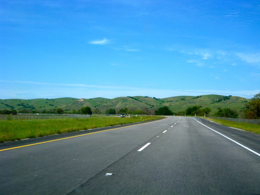
The mountains outside Buellton and up north were green green green
We Arrived At Saratoga And Went To "La Fondue" For Dinner
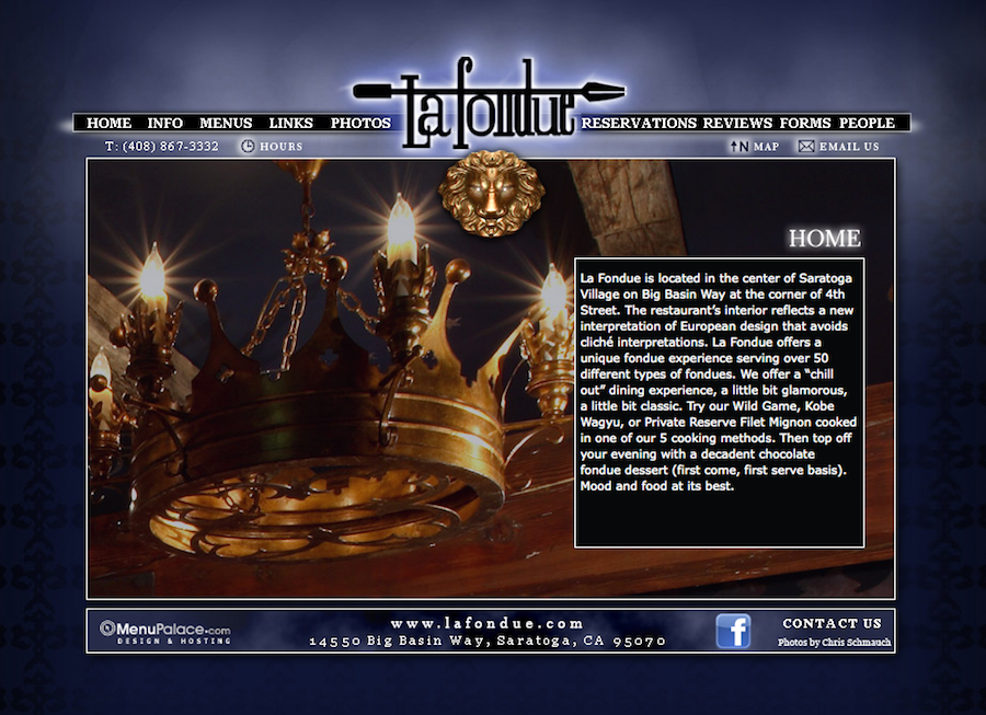
Good groceries at La Fondue

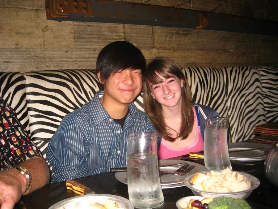
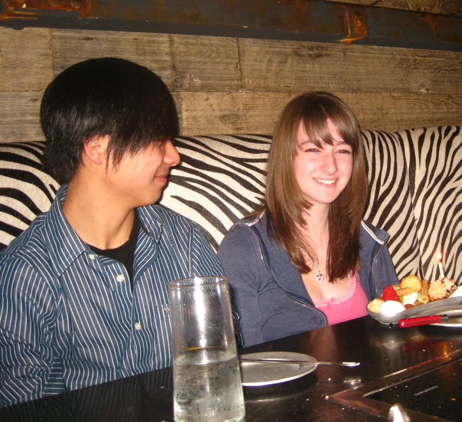
Teddy and Lisa joined us before their Sadie Hawkins Day Dance
Did You Know? - In Li'l Abner, Sadie Hawkins was the daughter of one of Dogpatch's earliest settlers, Hekzebiah Hawkins. The "homeliest gal in all them hills", she grew frantic waiting for suitors to come a-courtin'. When she reached the age of 35, still a spinster, her father was even more frantic—about Sadie living at home for the rest of his life. In desperation, he called together all the unmarried men of Dogpatch and declared it "Sadie Hawkins Day". Specifically, a foot race was decreed, with Sadie in hot pursuit of the town's eligible bachelors—and matrimony as the consequence.
"When ah fires [my gun], all o' yo' kin start a-runnin! When ah fires agin—after givin' yo' a fair start—Sadie starts a runnin'. Th' one she ketches'll be her husbin." The town spinsters decided that this was such a good idea, they made Sadie Hawkins Day a mandatory yearly event, much to the chagrin of Dogpatch bachelors. In the satirical spirit that drove the strip, many sequences revolved around the dreaded Sadie Hawkins Day race. If a woman caught a bachelor and dragged him, kicking and screaming, across the finish line before sundown—by law he had to marry her!
Sadie Hawkins Day was first mentioned in the November 13, 1937 Li'l Abner daily strip, with the race actually taking place between November 19th and November 30th in the continuity. It would prove to be a popular annual feature in Li'l Abner, and a cultural phenomenon outside the strip. (see Schreiner, Dave; "Sadie's First Run", Li'l Abner Dailies Volume 3: 1937, Kitchen Sink Press, Princeton, WI, pg. 8.)
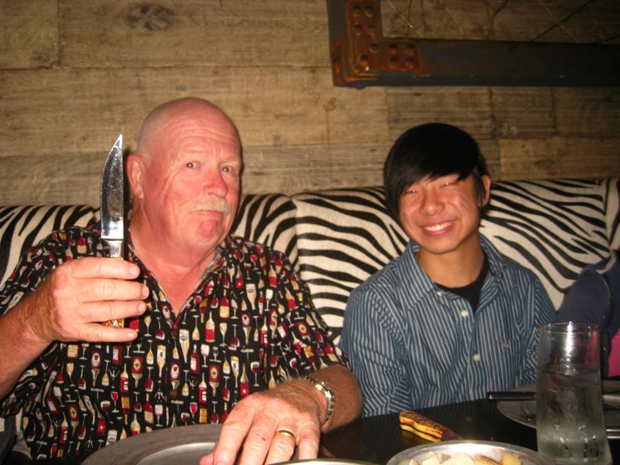
Paul discusses dating Lisa with Teddy... We had an "Understanding"
Teddy was new to fondue but managed quite well

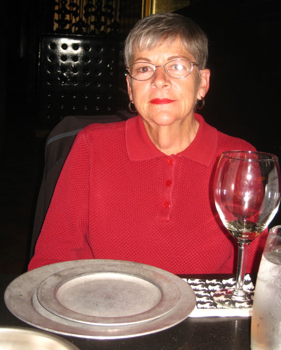
Mom and Dad approve

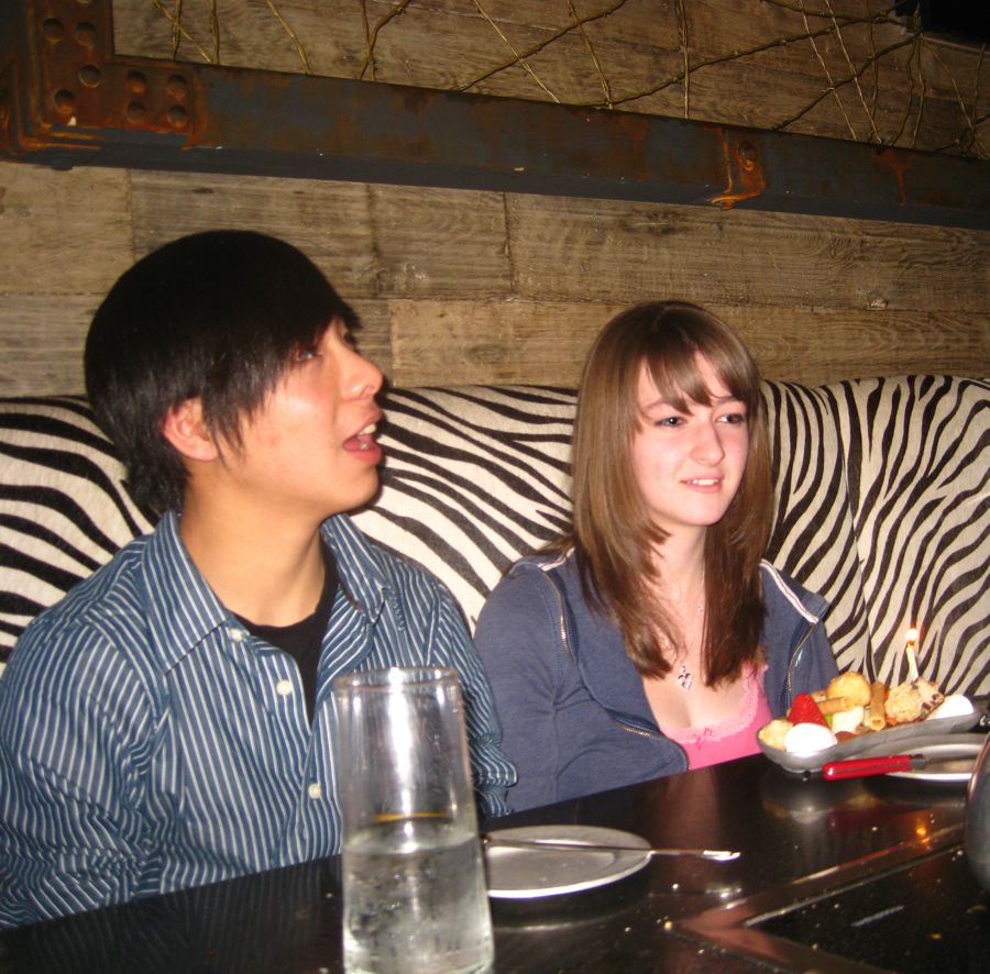
The poor waiter got a dose of "Unkle Paul"
this evening
... Remember the upsidedown menu?
Sue has Paul under control... Sort of

Cheese enters the hot oil.... Dinner is about to start
Did You Know? - The earliest known recipe for cheese fondue as we know it today comes from a 1699 book published in Zurich, under the name "Mass mit Wein zu kochen" 'to cook cheese with wine'. It calls for grated or cut-up cheese to be melted with wine, and for bread to be dipped in it.

The waiter got a workout
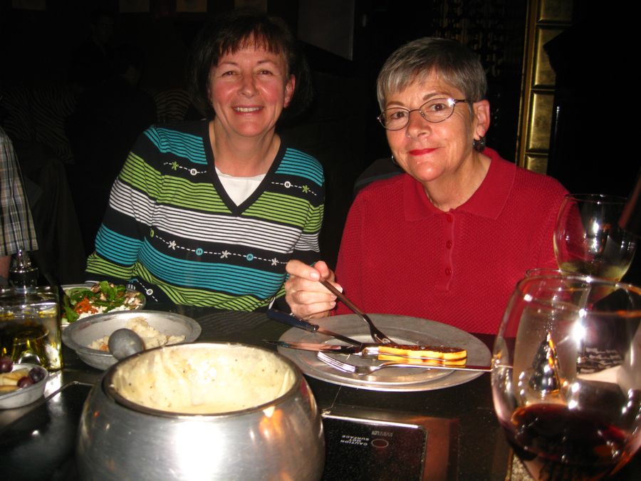
Sisters, sisters..
Did You Know? - "Sisters" is a popular song written by Irving Berlin in 1954. The song appeared in the movie White Christmas where it was sung by Rosemary Clooney and Trudy Stevens (Vera-Ellen's singing vocal dub for the film).
The movie White Christmas also starred Bing Crosby and Danny Kaye. It was not possible to issue an "original soundtrack album" of the film, because Decca Records controlled the sound track rights, but Clooney was under exclusive contract with Columbia Records. Consequently each one issued a separate "soundtrack recording": Decca issuing Selections from Irving Berlin's White Christmas, while Columbia issued Irving Berlin's White Christmas. On the former, the song "Sisters" (as well as all of Clooney's vocal parts) was recorded by Peggy Lee, while on the latter, the song was sung by Rosemary Clooney and her own sister, Betty. The Clooney sisters' version, which was also released as a single, was the most popular recording of the song, charting in 1954. The song was also made famous in the United Kingdom by sister act the Beverley Sisters.
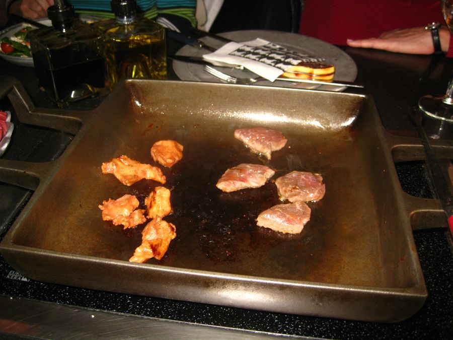
The "Wild Thing: gets cooked
Alligator, Buffalo, Llama, Ostrich, Venison, Wild Boar
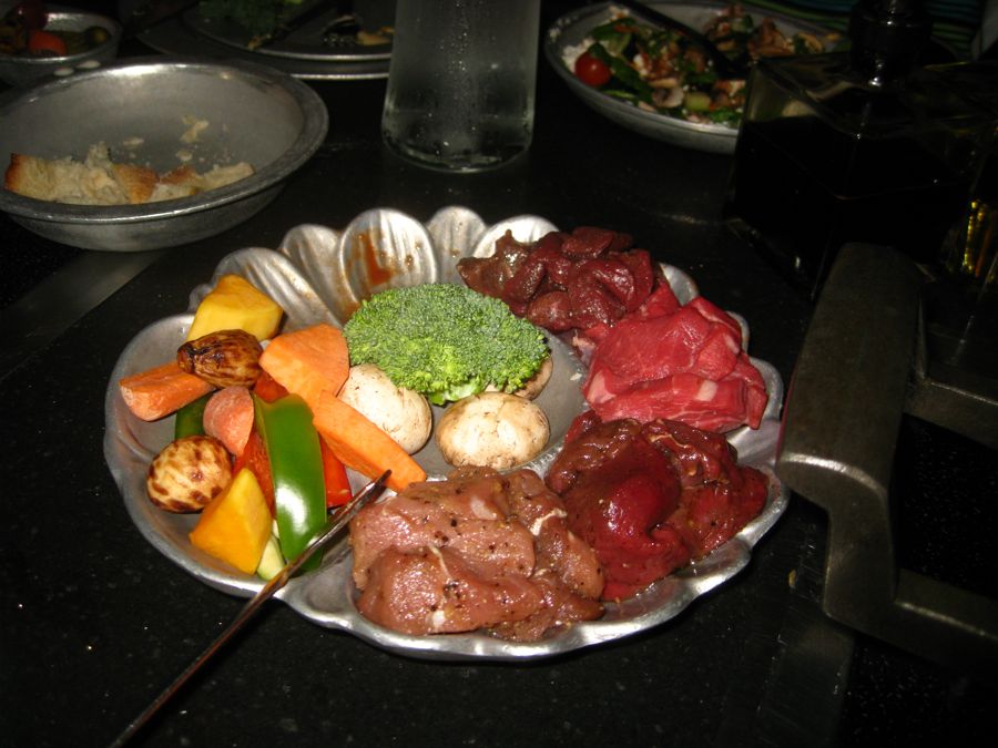
Alligator, Buffalo, Llama, Kangaroo, Venison, Wild Boar... Which is which???
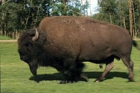
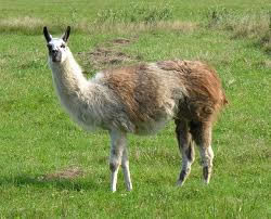
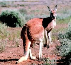


Can't believe Teddy and Paul ate the whole thing
Did You Know? - Llamas appear to have originated from the central plains of North America about 40 million years ago. They migrated to South America about 3 million years ago. By the end of the last ice age (10,000–12,000 years ago) camelids were extinct in North America. As of 2007, there were over 7 million llamas and alpacas in South America and, due to importation from South America in the late 20th century, there are now over 158,000 llamas and 100,000 alpacas in the US and Canada.

Champagne for the birthday girl!!
Teddy and Lisa are getting into this Fondue thing
"I ate what????"

"Over the tonsils,
Through the gums,
Look out tonsils
Here it comes"
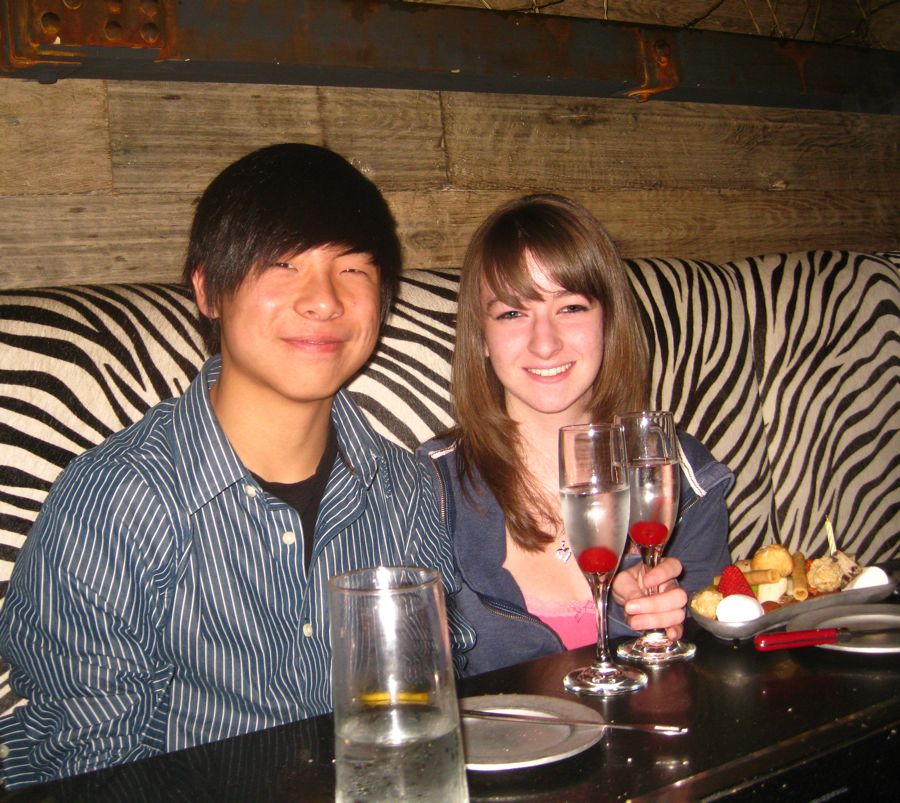
They are prepared for Sadie Hawkins now
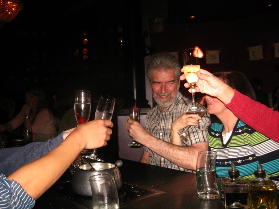
Clink clink clink
Sunday Morning And We Are Off To Rio Vista And Stockton
We be off and running
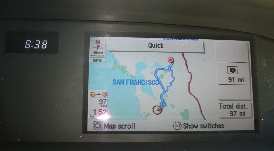
GPS tells all...
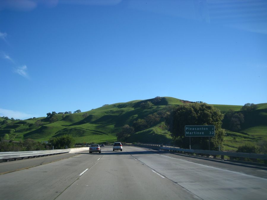
 Most Of The Way Was On 680

Highway 4
began for us off of 680 near Concord
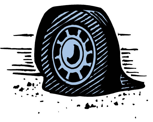
All was going well when were heard a funny sound..... Pssssssssssssst
Paul outside working and Sue reading the instruction manual...
We changed tires in 20 minutes flat (escuse the pun)
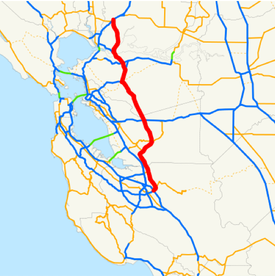
Route 680 - Length: 70.536 mi (113.517 km)
History: State highway in 1933; Interstate in 1955
Did You Know? - By the 1920s, a road ran south from Martinez through Walnut Creek, Dublin, Danville, and Sunol to Mission San Jose, where it met State Highway Route 5 (Mission Boulevard, signed over the years as US 48, US 101E, SR 9, and now SR 238). It was not yet paved south of Dublin, where it crossed Mission Pass between the Sunol Valley and the San Francisco Bay basin. The majority of this roadway was added to the state highway system in 1933 as portions of several routes: Route 108 from Mission San Jose to Sunol, Route 107 from Sunol to Walnut Creek, and Route 75 from Walnut Creek to Pleasant Hill.
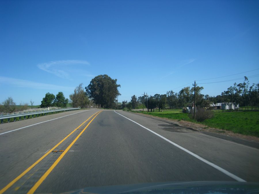
 A Few Miles On Highway 4 Between Concord And Antioch
Great ride along Highway 4
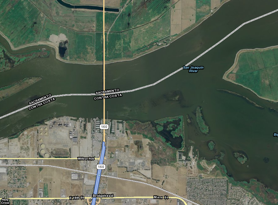
 We Turn Onto State Route 160
And Head North To Rio Vista
We Turn Onto State Route 160
And Head North To Rio Vista
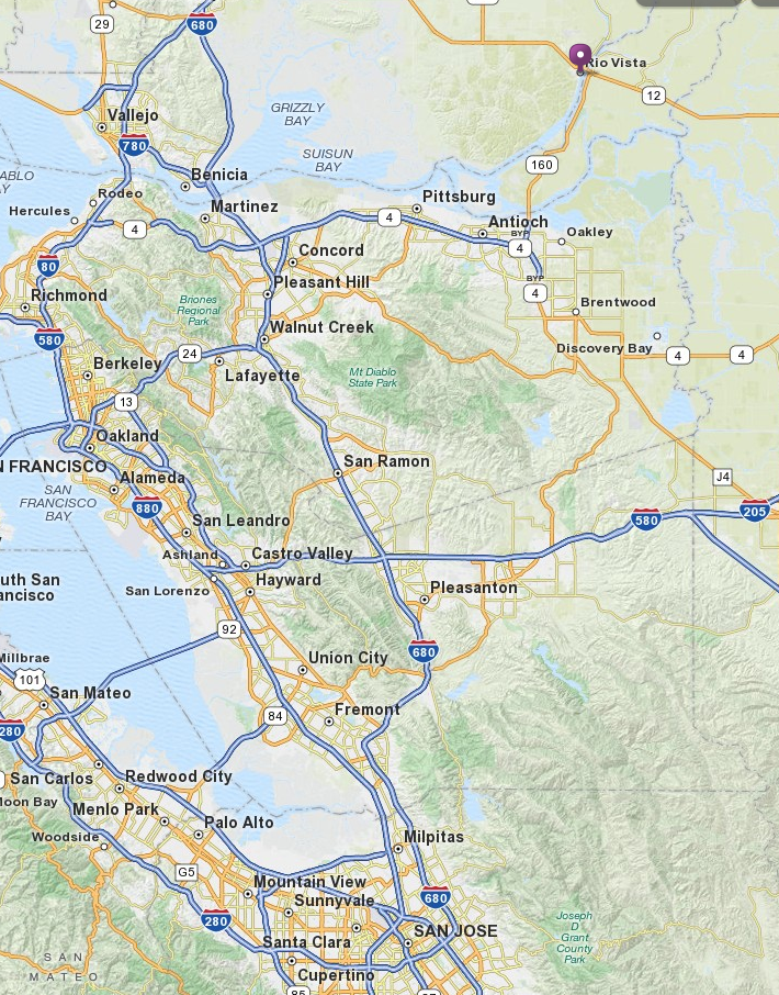
Saratoga To Rio Vista Was One Hour And Forty-five Minutes
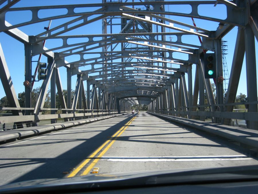
The Antioch Bridge Over The San Joaquin River
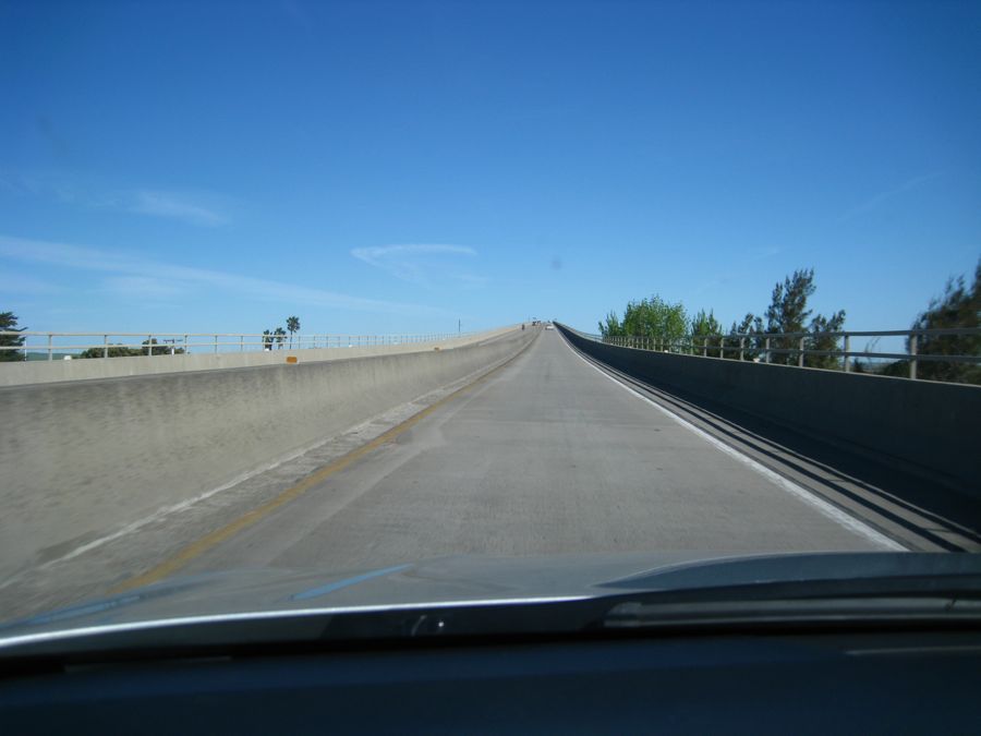
The Antioch Bridge went high over the San Joaquin River Bridge
Design steel plate girder
Total length 9,504 feet (2,897 m)
Vertical clearance 135 feet (41 m)
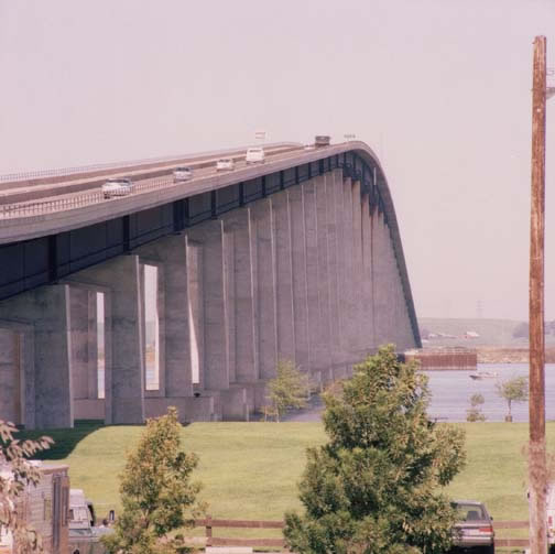
The Antioch Bridge
Did You Know? - The $41 million Antioch Bridge (John A. Nejedly Bridge) was opened to traffic in December 1978, and carries over 9,700 vehicles daily.
The current bridge was completed and opened to traffic in 1978. It measures 1.8 miles (2.9 km). It replaced the original structure that was built in 1926 by Aven Hanford and Oscar Klatt, who went on to build the original span of the Carquinez Bridge.
The original lift span bridge was plagued with problems throughout its lifetime. Heavy traffic could cross it at no more than 15 miles per hour (24 km/h), and its narrow shipping canal led to collisions in 1958, 1963 and 1970.
The 1970 collision spurred efforts to build a replacement bridge. In that incident, the lift span was stuck in the raised position.
The bridge tender could not leave the bridge and remained in the control house for three days.
Local firemen eventually made their way to him and brought him out, and he immediately quit his position.
He went on to tend bridges in the Ryde/Walnut Grove area for many years.
The bridge was tolled when it first opened, but tolls were removed after the state bought the bridge in 1940. Tolls were reinstated with the construction of the new span.
It looked like we were a mile in the air... It was only 140 feet
Drive My Chevy Toyota To The Levee But The Levee Was Dry Wet
We rode alongside the levees for miles

Did You Know? - A schematic cross section figure of the river levees. I did not put text in this schema to ease translation to other wikis.
- Design High Water Level (HWL)
- Low water channel
- Flood channel
- Riverside Slope
- Riverside Banquette
- Levee Crown
- Landside Slope
- Landside Banquette
- Berm
- Low water revetment
- Riverside land
- Levee
- Protected lowland
- River zone
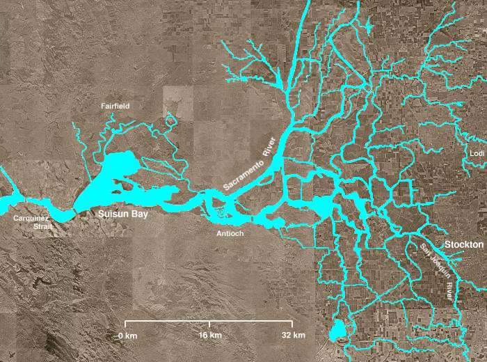
The levee system is quite complex
Did You Know? - The en:Sacramento-San Joaquin River Delta covers the right half of this image. The Sacramento River flows into the delta from the north and the en:San Joaquin River from the south. The Mokelumne River enters from the east, flows northwest from Lodi, picks up several tributaries including the Cosumnes River, then turns south, meandering among several delta sloughs and waterways, ultimately flowing into the San Joaquin in the center of the delta, northeast of Antioch.
The body of water near the bottom of the image is Clifton Court Forebay, where pumps lift water to be sent southward. Several other open areas in the right half of the image are "islands," many of which have elevations well below sea level. Waterways (in blue) are clearly visible, as are fields and croplands (which appear as en:patchwork) and urban areas (especially Stockton).
The San Joaquin and Sacramento rivers meet just west of Antioch and their confluence continues westward into Suisun Bay and then the:Carquinez Strait.
Over The "Three Mile Slough Bridge" We Go...
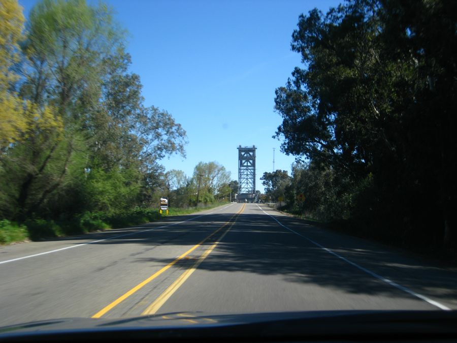
Three mile slough coming up
Did You Know? - The total area is around 1,100 square miles (2,800 km2), around 70 reclaimed islands and tracts, surrounded by 1,100 miles (1,800 km) of levees surrounded by 700 miles (1,100 km) of waterways. The delta was originally marshland; reclamation was made by the building of levees, by Chinese laborers in the 1850s.
A typical levee was constructed as being approximately trapezoidal, 10 ft (3.0 m) above original ground level, and approximately 30 ft (9.1 m) wide at the base rock armoured on the river side. The construction was a colossal engineering undertaking.

Crossing a slough... What is a slough???
Did You Know? - A slough in hydrology :
- Slough, a muddy marsh (British Isles)
- Slough, a swamp or shallow lake system with trees (eastern and southeastern United States)
- Slough, a secondary channel of a river delta , without trees (west coast of North America)
- Slough, a pond , often alkaline (prairies of North America)
- Slough, a stream distributary or anabranch , or in some cases, a regular stream
A photographers delight... Too bad we were going 30 mph

Almost clear of the bridge
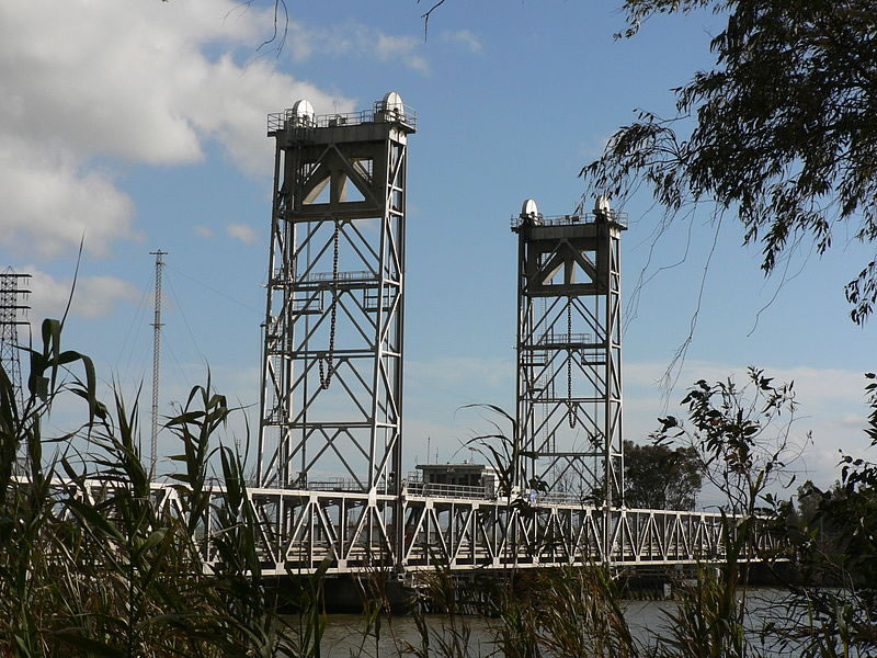
The 1949 Three Mile Slough Bridge for State Route 160 in the
Sacramento River Delta
Using the definition of a "slough", it passes with flying colors
We Are About The Cross The Mighty Sacramento River And Into Rio Vista

The bridge over the mighty Sacramento River at Rio Vista
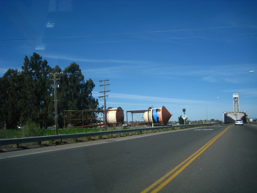
We were curious about the water towers... The community is trying to get them raised... Good luck

Here we go
and a mighty river it is
Almost 500 miles in length
The aerial view show the geography


We Are In Rio Vista
Miles and miles of country
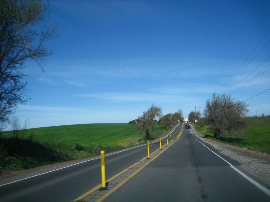
Cousin Delores Lives In Rio Vista
Did You Know? - Rio Vista is a city located in the eastern end of Solano County, California in the San Francisco Bay Area, on the Sacramento River, in the Sacramento River Delta region. The population was 4,571 at the 2000 Census but had risen to over 8,000 by late-2010.
Rio Vista was visited by a lost Humpback whale in 1985, despite being 60 miles (100 kilometers) upriver from the Pacific Ocean. The young whale, nicknamed "Humphrey", attracted throngs of curiosity seekers before he was eventually guided back to sea by rescuers. Again in May 2007, Humpbacks were sighted in Rio Vista. "Delta" and "Dawn," mother and calf, stopped at least twice in the river near the town.
We were so bust visiting the photographer forgot to take a picture
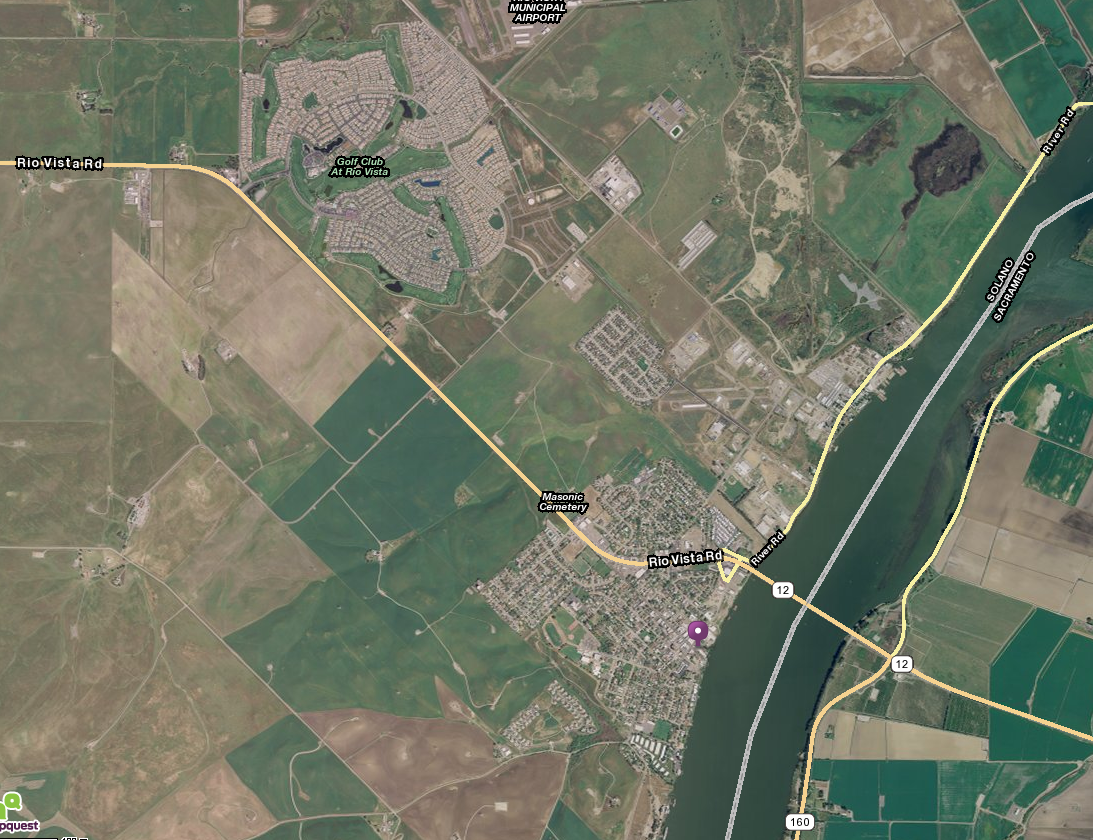
Cousin Delores lives at the Trilogy Golf Club just northwest of town
Off We Go To Stockton, California

Back down 160 all the way to Highway 99!

Aunt Kaye bought us a beautiful wine decanter.... Perfect!

This will get used every day

We headed for Strings (our favorite local restaurant) and passed the cherry trees
Did You Know? - The native range of the wild cherry extends through most of Europe, and the fruit has been consumed through its range since prehistoric times. A cultivated cherry is recorded as having been brought to Rome by Lucius Licinius Lucullus from northeastern Anatolia, also known as the Pontus region, in 72 BC.
A form of cherry was introduced into England at Teynham, near Sittingbourne in Kent by order of Henry VIII, who had tasted them in Flanders.
The English word cherry, French cerise, Spanish cereza all come from the Classical Greek (κέρασος) through the Latin cerasum, thus the ancient Roman place name Cerasus, from which the cherry was first exported to Europe.
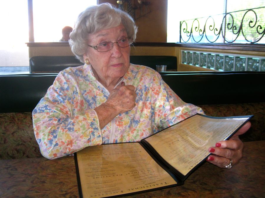
Aunt Kaye knows the menu well! Too bad Tom had to work! We missed him

No Aunt Kaye, you cannot have one of each!!

She is narrowing down on a selection

Our tummies are full and we are ready for six hours in the car.....
We Are Off At 2:00PM For A Run Home
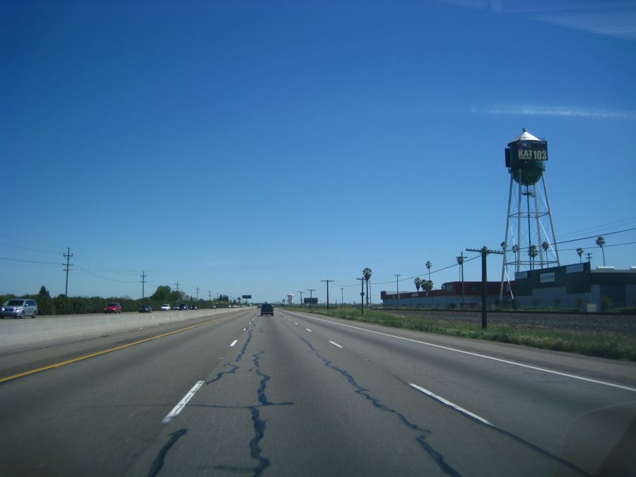
Love the cities on 99 with their water towers
Did You Know? - A water tower or elevated water tower is a large elevated water storage container constructed to hold a water supply at a height sufficient to pressurize a water distribution system. Pressurization occurs through the elevation of water; for every 10.20 centimetres (4.016 in) of elevation, it produces 1 kilopascal (0.145 psi) of pressure. 30 m (98.43 ft) of elevation produces roughly 300 kPa (43.511 psi), which is enough pressure to operate and provide for most domestic water pressure and distribution system requirements.

The rest stops are super after a filling Italian lunch... Got to stretch the legs

The flowers were magnificent along the highway... Even at 75 miles an hour
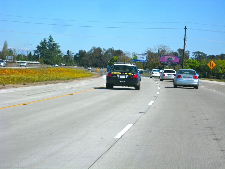
Oops... Did I say "75"
Did You Know? - U.S. Route 99 was the main north–south highway on the West Coast of the United States until 1964, running from Calexico, California, on the U.S.-Mexico border to Blaine, Washington, on the U.S.-Canada border. It was a route of the United States Numbered Highways, assigned in 1926 and existing until it was replaced for the most part by Interstate 5.
Known also as the "Golden State Highway", "The Main Street of California" and "US 66 turned the opposite way", US 99 was an important route in California throughout much of the 1930s as a route for Dust Bowl immigrant farm workers to traverse the state.
Large portions are now California's State Route 99, Oregon Route 99, and Washington's State Route 99. The highway connected to British Columbia Highway 99 at the Canadian border.

The Southern Pacific at work

This train was traveling in our direction!
Did You Know? - An extensive section of this highway (over 600 miles), from approximately Stockton, California to Vancouver, Washington, follows very closely the track of the Siskiyou Trail. The Siskiyou Trail was based on an ancient network of Native American footpaths connecting the Pacific Northwest with California's Central Valley.
By the 1820s, trappers from the Hudson's Bay Company were the first non-Native Americans to use the route of U.S. Highway 99 to move between today's Washington state and California. During the second half of the 19th Century, mule train trails, stagecoach roads, and the path of the Central Pacific railroad (later the Southern Pacific railroad) also followed the route of the Siskiyou Trail.
By the early 20th Century, pioneering automobile roads were built along the Siskiyou Trail, including most notably the Pacific Highway. The Pacific Highway ran from British Columbia to San Diego, California and is the immediate predecessor of much of U.S. Highway 99.

Sorry about the glare but we had to drive and snap at the same time
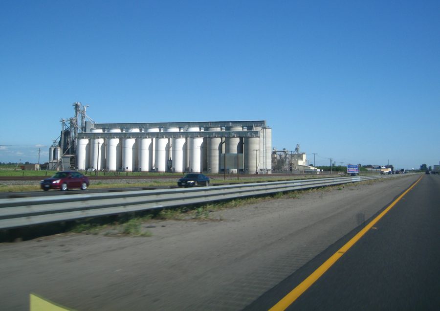
Grain elevators up and down the highway
Did You Know? -Prior to the advent of the grain elevator, grain was usually handled in bags rather than in bulk (large quantities of loose grain). The elevator was invented by a merchant named Joseph Dart and an engineer named Robert Dunbar during 1842–43, in Buffalo, New York. Using the steam-powered flour mills of Oliver Evans as their model, they invented the marine leg, which scooped loose grain out of the hulls of ships and elevated it to the top of a marine tower.
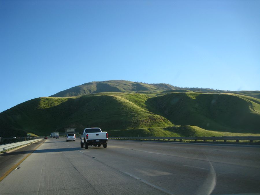
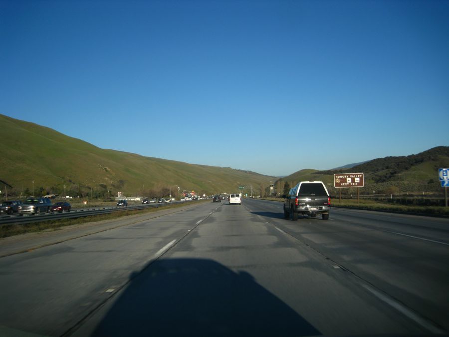
The Grapevine In The Daylight... Something New For Us

The winter/spring rains made for a beautiful view

We climb the grapevine into Los Angeles
Did You Know? - Grapevine is an unincorporated community in Kern County, California. At an elevation of 1499 feet (457 m), the community is located at the foot of a road grade known as The Grapevine through the Tejon Pass in the Tehachapi Mountains at the southern end of the San Joaquin Valley along Interstate 5 (formerly U.S. Route 99).
The village consists mainly of roadside services. The village and grade are named, not for the once-winding road known as the Ridge Route that used to climb the steep mountain pass , but for the wild grapes that still grow along the original road.
The grade was infamous for its high accident rate before the road was straightened and widened.
The road is still occasionally closed due to heavy snowfall during winter storms. As the Grapevine is the major route between Northern and Southern California, any closure is a major disruption to traffic along the West Coast.

Beautiful at 70 mph
Camera goes down as we are now into LA traffic

Home safe and sound 8:30... Time to feed the babies and watch a movie