 We Jumped Into The Ditch And Saw The World
Ballona Creek - My Little Mississippi

While growing up, Baloney Creek was at the end of our dead end street! I remember it looking to be 200 feet deep but in reality it was not! Maybe 20 or 25 at most.
As a boy, I would tie a rope to my bicycle and lower it down the side into the cement bottom... then use the maintenance ladder to get to the bottom!
We could only do this after winter rains came along because many times of the year, the bottom of the creek had several inches of MUCK on it!
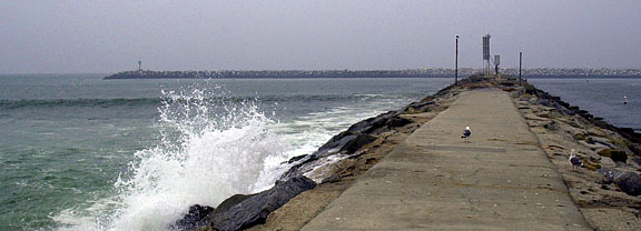
Ballona Creek is the largest storm drain in the Santa Monica Bay watershed.
So, how did I know about La Ballona? Or we called it, Baloney Creek! I was born six houses from the large concrete ditch.
I did now know until I was in my 50's that Mom would follow me down to the ladder and nring a chair and knit until she heard us coming back up the creek and then she would go home and ask us" Where have you been".
I Lived On The Poor Man's Mississippi
I lived my first 16 years at the corner of La Cienega (The Swamp) and Venice (think waterways) on a street called Comey Avenue.
La Ballona creek was indeed a river at one time and then over the years it became a flood control channel for LA. As houses built up, the channel was changed from dirt banks to concrete reaching almost 2 feet down into the ground.
The creek meandered through Los Angeles and down by the Baldwin Hills and between the Baldwin Hills and the MGM back-lot. In the beginning, Ballona Creek ran placidly (usually) from the LaBrea tar pits, meandering unimpeded across the broad marshy flood plain to the ocean. Much of the Los Angeles Basin was marsh at that time, and the inversion layer that traps smog so efficiently now, trapped moisture and warmth then.
"A watershed is that area of land, a bounded hydrologic system, within which all living things are inextricably linked by their common water course and where, as humans settled, simple logic demanded that they become part of a community."
- John Wesley Powell
When Harry Culver saw filmmaker Thomas Ince shooting one of his famous western movies "on location" on Ballona Creek, he enticed Ince to move his studio to Culver City.
La Cienega

I live at the corner of La Cienega (The Swamp) and Venice (think waterways) on a street called Comey Avenue.
In the 1950s, about four miles of the creek lie within the City of Culver City. The rest of it is in the City of Los Angeles. For me growing up the Ballona Creek became my version of the Mississippi! Tom Sawyer had nothing on me except a lot more water. We kids would climb down into the channel and ride our bikes are hike for miles.
The creek sides were not paved and in some cases were still dirt and boulders when I was growing up. So we explored the nine miles rock by rock. I’ll bet I used ten boxes of band aids after falling and nicking myself on those rocks.
After a major storm, we saw all sorts of treasures. I’m surprised that I survived those explorations after seeing what goes into the channels today.
RKO Studios
RKO Studios which not only had sound stages in Hollywood and Culver City, but had a movie ranch in Encino and a back lot at the Culver City facility. It was at this Culver City backlit (nicknamed Forty Acres) that he built the RKO Tarzan tree house in a jungle area separated from the main back lot by Ballona Creek. A lot of the jungle scenes were lensed at this site.
The creek became an African jungle because large trees grew by the side of the creek (where rocks were used to control the banks… no concrete yet!). I remember seeing Tarzan’s tree house from the banks of the creek! We even saw them shooting one day and had to leave at the bequest of the studio guards. I guess they did not want kids dressed as cowboys popping up in the jungle.
My creek also stared in a movie called Volcano. Tommy Lee Jones was a Los Angeles emergency official who takes charge when a volcano grows out of the La Brea Tar Pits. A river of lava flows down Wilshire Boulevard, through the uncompleted Metro Red Line subway tunnel, and creates a fountain of lava next to the Beverly Center shopping mall in Beverly Hills .In spite of placing himself and his teenage daughter in danger, Mike saves the city by diverting the river of lava into the concrete channel of Ballona Creek, which allows the lava to flow safely into the Pacific Ocean Today, things have changed. Ballona Creek is a nine-mile-long flood control channel. It drains theBallona Creek watershed, which covers approximately 130 square miles: from the Santa Monica mountains on the north to the Baldwin Hills on the south, and from the Harbor Freeway (110) on the east to the Pacific Ocean. A paved service road for County maintenance vehicles runs along the westernmost seven miles, as does a bike path
Nothing changed here! During dry weather the creek flows with urban runoff; the water level and speed increase dramatically during storms. That runoff contains all sorts of pollutants from our air, yards, businesses, schools, and streets - trash, animal waste, oil and grease, pesticides and fertilizers, industrial chemicals. One often finds large items, such as shopping carts, which have been dumped in the creek. Algae accumulates in some places and graffiti in others.
Ballona Creek drains a 130 square mile-area extending as far east as Griffith Park and the Los Angeles Civic Center. The area is 64% residential, 8% commercial, 4% industrial, and 17% open space
Ballona Creek, originally, was a picturesque natural waterway fed by runoff. The creek collected the water from cienegas (swamps) and the rains. The banks of Ballona Creek were lined with trees, like sycamores, willows and tules, and it became a forest for us kids to play in... even in the 1950's!
The creek was a natural resource for the indigenous people. The Native Americans in this area made board boats, which they waterproofed with asphalt from nearby La Brea Tar Pits. They used the waterway for transportation and to fish for their food. From accounts of these people, who were called the Gabrielinos, they used the tules along the creek to make huts for shelter, and they knew of the rising water and the danger it could present.